by sdpacatc | May 13, 2014 | Hikes

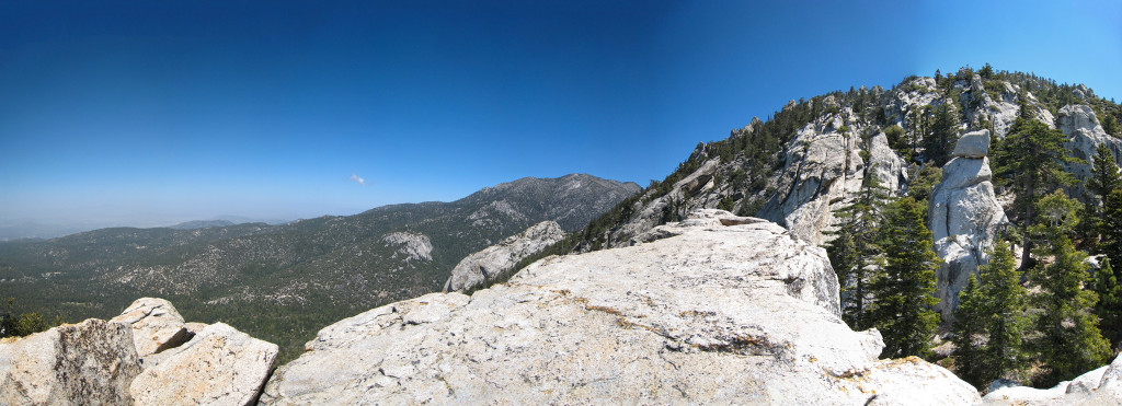
Looking towards Suicide Rock and Lily Rock on the way up to Tahquitz Peak
This last Sunday ( Mothers Day) was a great day for a hike, so I decided to do just that, I meet my mother up in Idyllwild and we went on a great hike up to Tahquitz Peak along the South Ridge Trail. I originally wanted to go from the Devils Slide over to Tahquitz Peak but my mother wanted to save her knees and said the Southridge Trail would be better for her, I’m glad we went this way, the views from this trail are awesome, and even though it is a moderate trail, the last mile started to give me a good workout. Make sure you take a vehicle that has good clearance, the dirt road isn’t to bad but there are some ruts along the road and I wouldn’t want to take a vehicle that is low to the ground up that road.
https://www.ihikesandiego.com/south-ridge-trail-tahquitz-peak/
by sdpacatc | Apr 29, 2014 | Hikes

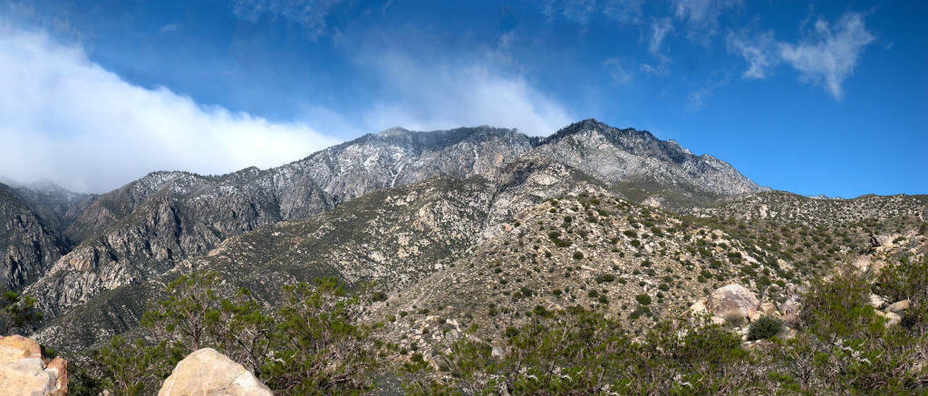
Looking towards the top of the ridge covered in snow
This last weekend was perfect for hiking the famous Skyline Trail ( part of Cactus to Clouds). Even though we were expecting some pretty bad weather by the time we started the hike at 4:30 am, the weather had started to clear up somewhat after having deposited 4 inch’s of fresh snow on top of San Jacinto. We arrived “loaded for bear”, poncho’s, rain covers for the backpacks, extra layers for the blustery winds and low temperatures that were reported etc, but soon we were stripping off the rain gear, the winds never really picked up on Saturday, and although it was 38 degrees at the top of the tram, all the heat we were producing while hiking keep us from getting cold, so the extra layers were never needed. We were humbled by the mountain though. Our intention was to go all the way up to the top of San Jacinto, but by the time we got up to the tram we were just ready to sit back with a beer or two and call it a day.
https://www.ihikesandiego.com/skyline-trail/
by sdpacatc | Apr 14, 2014 | Hikes

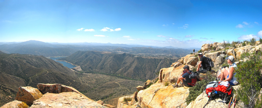
Checking out the view from the El Cajon Mountain Cliff Face

Coming back, about half way down

Getting buzzed by the San Diego Sheriffs Chopper on El Cajon Mountain
What a great weekend for a hike. My buddies and I needed a training hike for our upcoming hike up “Cactus to Clouds“, so I took them to El Cajon Mountain, 12-14 miles of grueling up and down steep inclines in order to torture our legs and get our minds set “Cactus to Clouds” or how you will some times see it listed C2C. This is not a hike that you want to do on a hot day, in fact they close the park down during the month of August because of the excessive heat. This a great training hike for harder hikes to come, such as San Gorgonio, Mt Whitney, Half Dome, etc. If you decide to challenge yourself with this hike make sure to bring a lot of water, I went through 4 liters on a cool day, and start this hike early, like at least by 6am, so you can get up to the top before the heat starts. Lastly, after doing this hike several times I would suggest that you do the extra mile or so out to the cliff face, it doesn’t add that much as far as intensity to the hike, but the view is to kill for.
https://www.ihikesandiego.com/el-cajon-mountain-hike/
by sdpacatc | Apr 6, 2014 | Hikes
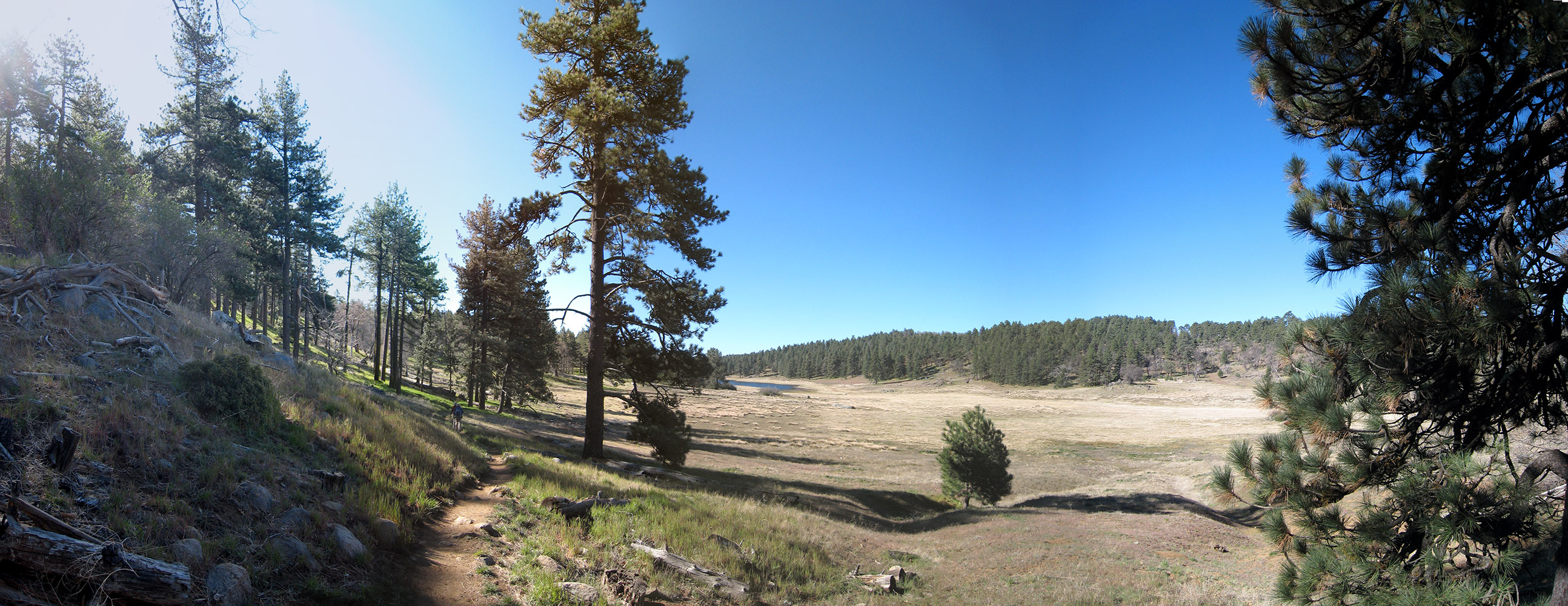
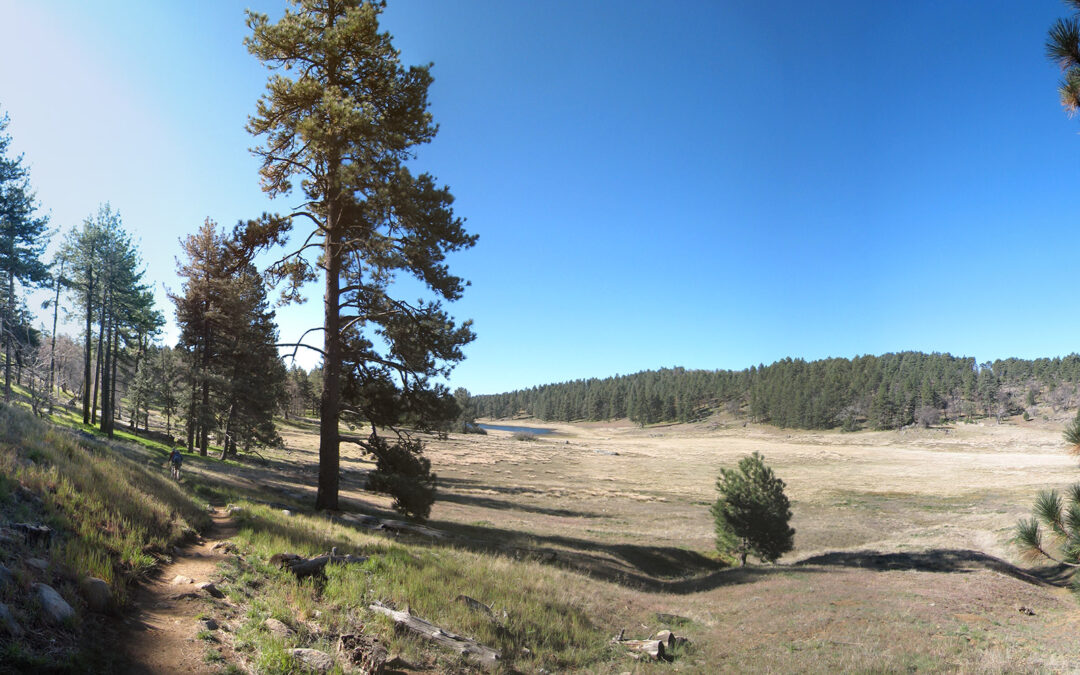
Hiking along Laguna Meadow with the Laguna Lake in the distance on the Big Laguna Trail
What a wonderful day for hiking this trail, the sun was out, and it wasn’t to hot, in fact in had snowed a few inches only a couple of days previous, but signs of any remaining snow where hard to find. This trial is usually described as being a moderately strenuous hike but after hiking this hike today I would have to classify this hike as an easy to moderate hike. The only reason it even becomes moderate is the mileage of the hike, other then that you really don’t gain much in altitude nor is the terrain very challenging. The views are spectacular through. The views of Laguna Meadows as you hike along the meadow and the lake, and the views of the Anza Borrego desert seen from sections of the Pacific Crest Trail as you head back to the trail head along the eastern ridge of the mountain, at some points seeing the landscape fall away a couple of thousand feet down to the desert floor below you. Defiantly worth the drive out. I saw hikers, bikers, backpacker, trail runners, and people just out enjoying a beautiful Sunday with their dogs on the trail.
https://www.ihikesandiego.com/big-laguna-trail/
by sdpacatc | Mar 30, 2014 | Hikes, Uncategorized

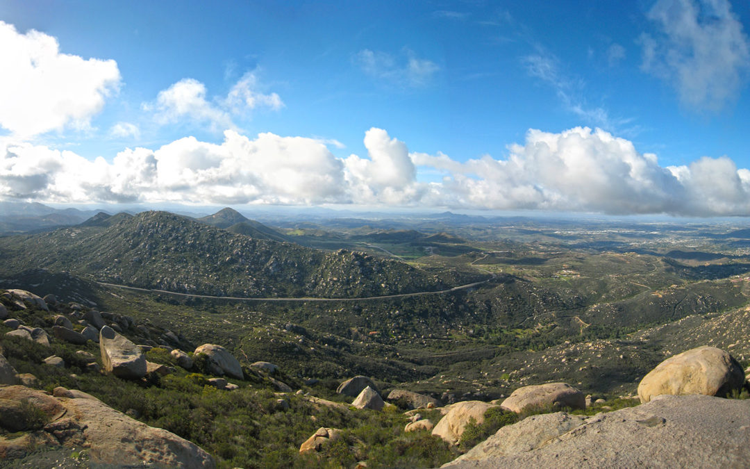
Looking towards Iron Mountain from Mt Woodson Summit
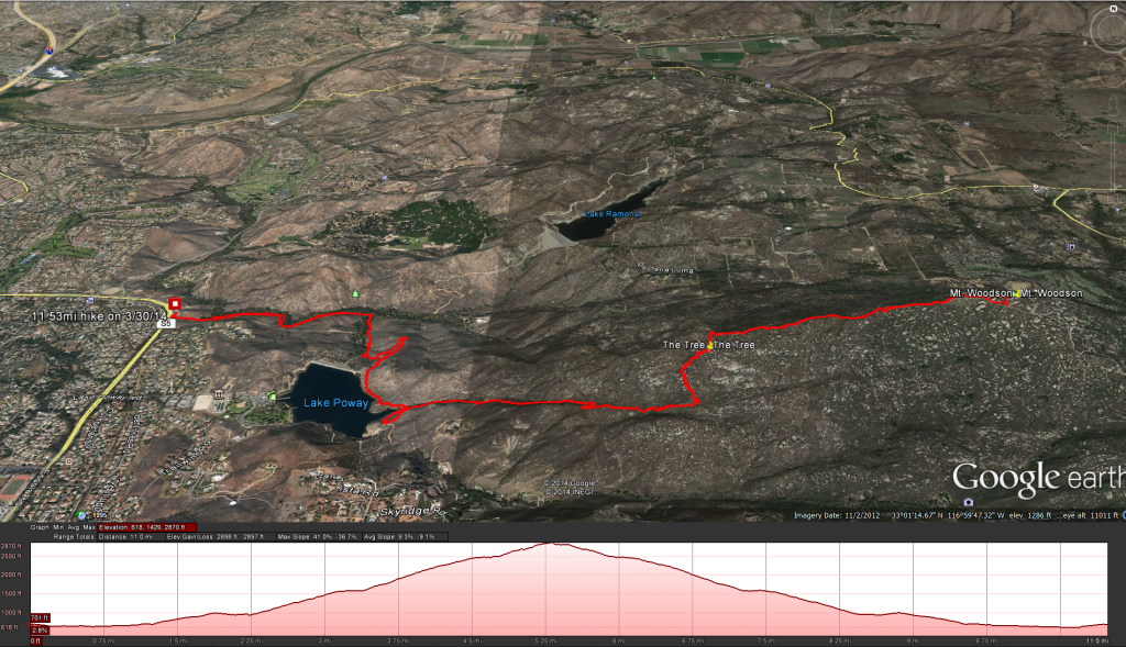
Blue Sky to Mt Woodson Summit
I read about this link to the Mt Woodson hike here in the San Diego Reader
Distance: 11 miles
Elevation Gained: 2357 feet with the top at 2816 feet.
Time to complete the trail: 4-5 hours.
Directions There: From I-15 take the Rancho Bernardo Road exit and turn right to continue on Espola Road for approximately 3 miles. Make a left into Blue Sky Ecological Reserve parking lot, which is open sunrise to sunset except for summer when open at 6:30 a.m. Vault toilets but no water available. Blue Sky Reserve Trailhead
What a perfect day for a hike. Blue sky, nice temperature, it just rained lightly the night before and there was still a scattering of clouds in the sky to give a little shade. Evidently everyone else thought the same thing because the line to get up and take your picture on potato chip rock looked like a Disney attraction line. The nice thing about taking this approach to the Mt Woodson summit was one the extra mileage, I’ve got to keep the miles on the legs as I get them ready for Cactus to Clouds. Another nice change of pace was the nice stroll through a nice grove of oaks, reminds me a little of Northern California. There is a little creek trail that is cool to take on the way back to the trial head, but it comes to an abrupt stop and you need to tromp through the brush to get back to the main trail. I would also love to see more people actually clean up after their dogs or at least push it off of the trail so that the rest of the people enjoying the trail don’t step in it, so keep your eyes open.
Weather forecast for the hike:
The location could not be found.
by sdpacatc | Mar 24, 2014 | Hikes, Uncategorized

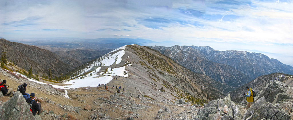
Heading down to the Devils Backbone from the peak of Mt Baldy
Climb for Heroes is a charity event to raise money for wounded veterens. All tax deductible donations go directly to The Heroes Project’s mission to organize climbs to the highest peaks in the world, each with our injured marines, soldiers and veterans. The event is held on Mt Baldy. I’ve been up Mt Baldy before and came back down the way I went up for this event and thought to myself that this way was kind of a joke after going up the shorter but much steeper side of Mt Baldy with the Sierra Club Ski Hut, but I’m here to tell you that the longer but less steep climb up to the notch and then along the Devils Backbone was no joke and still left me feeling like I had smoked a whole pack of cigarettes afterword’s. The event was well organized, signing in was a breeze, there was a nice little breakfast for you provided by Tender Greens. The first 15 minutes or so is this nice super steep road / trail that makes its way up to the main service road from the parking lot of the Mt Baldy Ski Area. Once up to the road its a nice long slog up to the “Notch” at Mt Baldy, technically the bottom of the ski area. A nice place to stop and take care of business before moving on. After passing the notch you will work your way up the ski area and towards the Devils Backbone. Once past the Devils Backbone you will see the peak ahead but the best is saved for last as you climb up the last hill close to 10,000 feet and sucking in O2 like its going out of style. The event has stations along the way where you collect coins that you then turn into the event coordinators at the bottom for swag. You will meet up with some of these vets at the different stations or even see them along the trail, stop and say hi. At station 3 they had beer and soda, but knowing there was still a but kicker of a hill coming up I decided to take a beer to go and celebrate at the top instead. This is a fun event for anyone living in Southern California and I would defiantly suggest this to anyone who likes to hike, and or supports our wounded warriors.
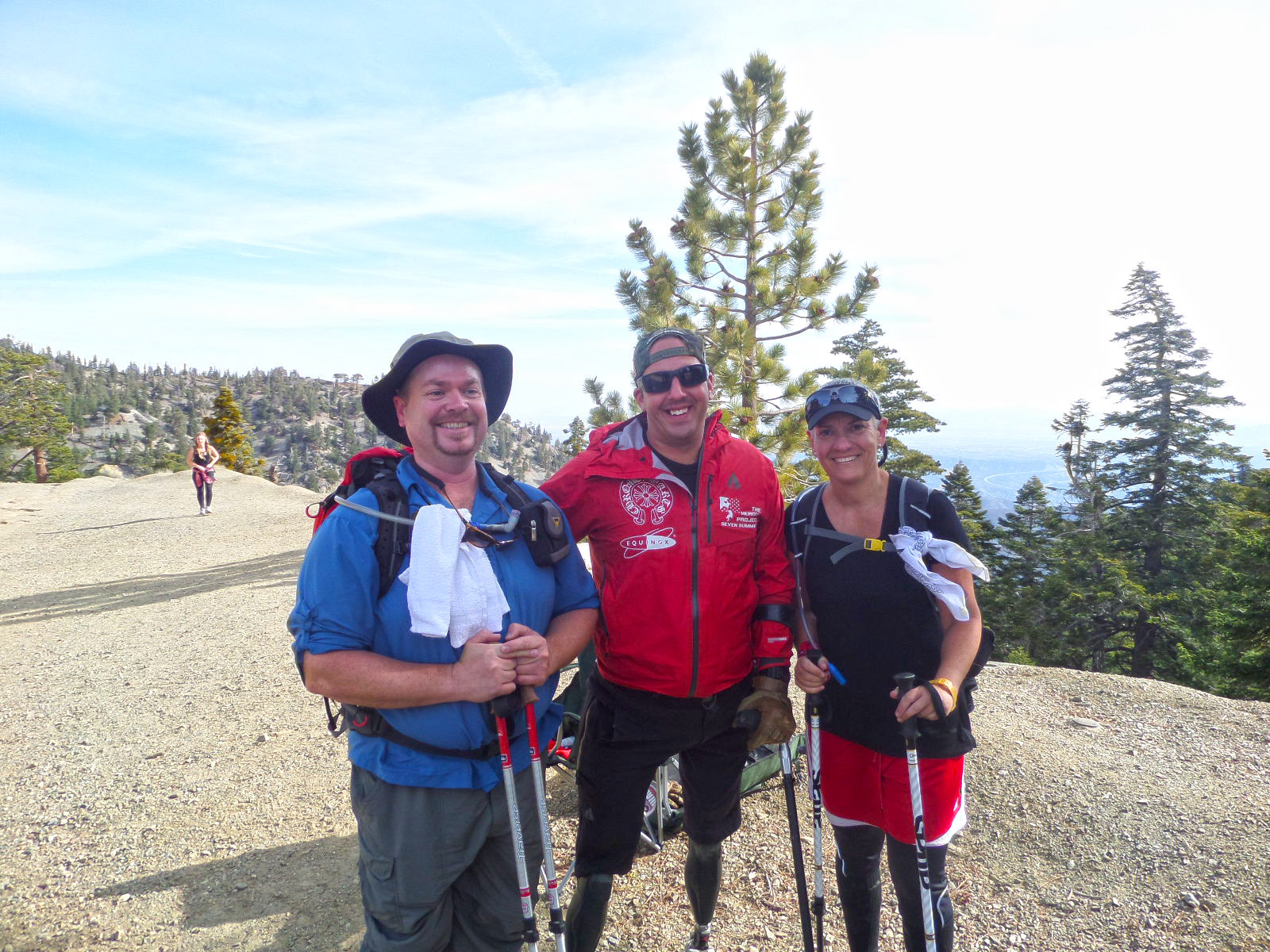
Posing with Mark Zambon
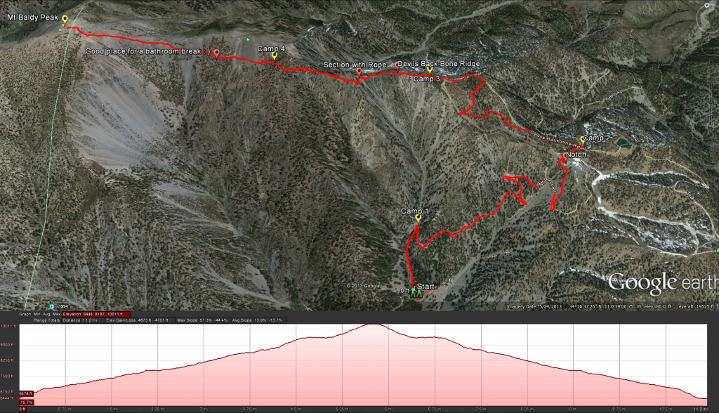
The route taken for the 2014 “Climb for Heroes”
Google Earth: The Route for Climb For Heroes 2014


