Google Earth El Cajon Mountain Hike
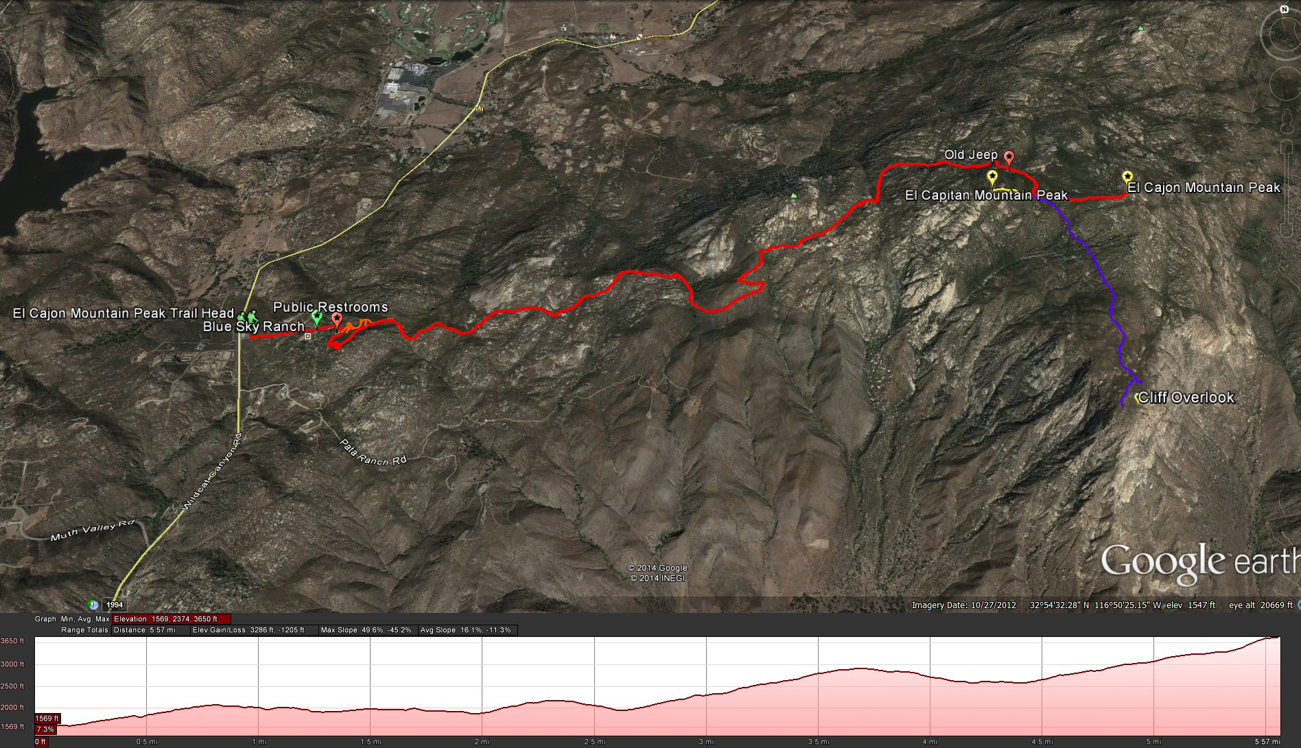
Distance: 12-14 miles round trip. ( depends on taking the trail to the cliff overlook or not) 12 miles to the peak, 14 miles if you include the side trip to the cliffs. Elevation Gain: 4100 feet Time to complete: 4-5 hours round trip for the peak. 6 -7 hours round trip for the peak and the cliffs.
** I was recently contacted by the San Diego River Park Foundation to inform me that there has been a change to the status of the face ( cliff areas ) of El Cajon Mountain. The property was acquired by San Diego Gas and Electric as mitigation for one its projects and then ownership was transferred to the San Diego River Park Foundation so that it could be maintained in perpetuity in conformance with a Conservation Easement which was placed over the entire property ** – San Diego River Park Foundation Web Page
Activities on this property focus on the preservation, restoration and enhancement of native species and habitats. Access to this property requires advanced authorization by the San Diego River Park Foundation. A sign is located on the Property informing visitors that this property is not for general public use.
This is not a Child Friendly Hike!
This is not a Pet Friendly Hike!
Equipment you will need: Hydration Pack is a must, you are going to need all the water you can carry, it gets hot out here. Good hiking shoes or boots, somthing with a lot of traction, you are going to want it on the long steep parts of this hike. Alpine Poles, these may help you on the steep areas of the hike. Food – you are going to need some energy for this hike. Cell Phone, – in case of emergency.
This is a long, hard hike! I’ve always read other peoples descriptions of hikes describing how hard the hike is and then found that the hike seems easier then described. Not so with this hike, I’ve read many descriptions of this hike and they always say how hard this hike is, how it’s a great hike for getting ready for other hikes like Half Dome or Mt Whitney, and they are not kidding, but then again maybe it was because my legs were cramping for the last 4 miles on the way down the hike.
To Get there: Take Highway 52 East or Interstate 8 East until you reach Highway 67. Follow Highway 67 north until Willow Road. Take a right onto Willow Road and follow it until you see Wildcat Canyon Road. Take a left onto Wildcat Canyon Road and follow it for 3.3 miles until you see the Trail Head for El Cajon Mountain
There is a parking lot at the start of the hike, but the gates are not open until 7am, and most people who are going to do the whole hike are usually going to start earlier, at least around 6am or earlier, so I would suggest parking on the road in front of the parking lot if you are going to get a early start. From the parking lot you are going to start up the road ( Shenma Rd) passing by some residential areas and the Blue Sky Ranch
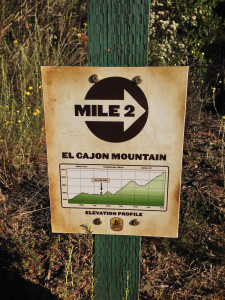
where you may hear some peacocks crooning in the early morning. As you pass by the Blue Sky Ranch you will round a bend and see the start of the hike. There are bathrooms here, so if you need to go, do it now. From this point you can take a little single track trail to your left that connects back into the main trial in 1/2 a mile or so or just stay on the main trail and start up the fire road. Soon after the single track trail connects back into the main trail you will see your first mile marker. These Mile Markers are a great way for you to keep track of your pace, and to realize just how much further you have to go, they display the mileage for each sign plus the elevation at each point . There are mile markers installed at mile 1, 2, 3, 3.5, 4, & 5 intervals. The only mile marker I came across that didn’t have a graphic representation of this was the 4 mile marker.
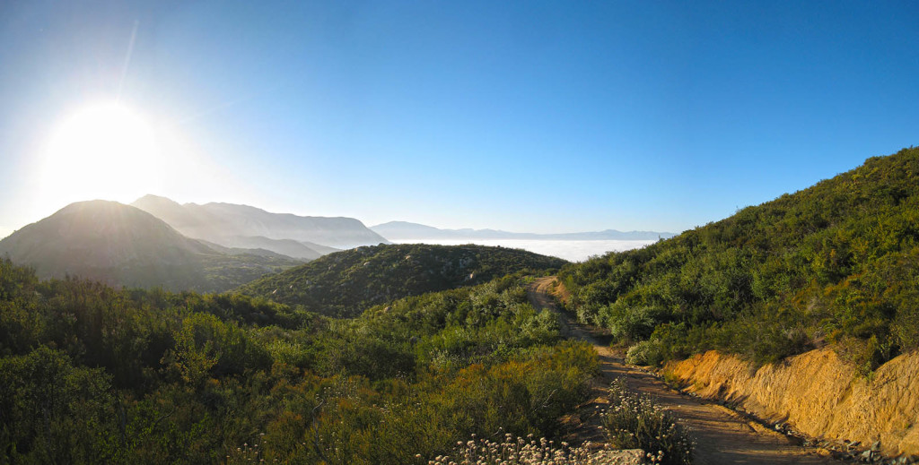
When you see descriptions of this hike that say you have up and down elements to this hike on both the way up and the way down they are not kidding. You will continue to climb up steep hills and back down into valleys as you continue to steadily climb up to the top of the peak. Just remember to stop every once in a while and enjoy the scenery. On some of these steep hills having a good pair of hiking boots was a god send, and even through I don’t own a pair of alpine poles I plan on picking up a good pair before I head up to Mt Whitney, and every time I saw someone on this trail using a pair I wish I had my own as well.
You will know that you are getting close to the top when you see the abdoned old rusty jeep. Soon after you will hit the point where the trail splits. If you head left you will continue up to the peak of El Cajon Mountain. If you head right you will go a shorter distance to the top of El Capitan Mountain. If you continue to go straight you will go to the cliff views over El Capitan Reservior, this will add a couple more miles to your hike, but its well worth the little bit of extra work, just realize that the trail down to the cliff views is not very well maintained and has some very deep ruts but the view will pay off. Also realize that the way up to El Cajon Mountain Peak from the junction is a small extremely poorly maintained trail ( barley a trail) and you really need to keep your eye on where you are going so that you don’t lose your way, especially on the way down.
Weather Forecast for El Cajon Mountain Peak:
Pictures from the hiking trail:


