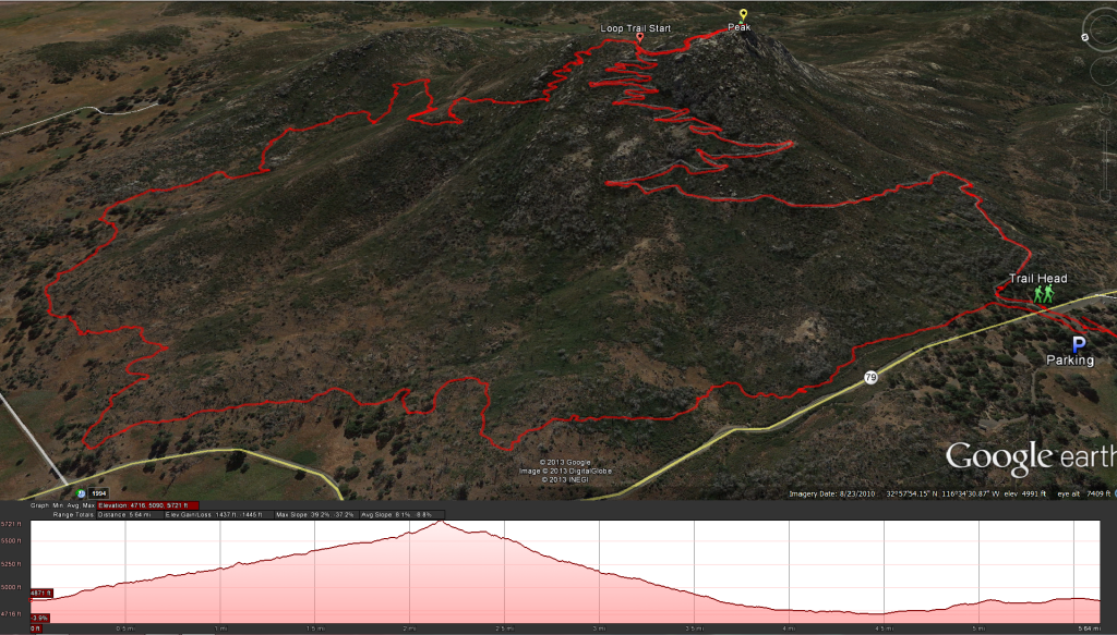
Distance: 5.8 miles on loop, 4.2 miles if you go up and back the switch backs. Elevation Gain and loss : 823 feet Time to complete: 2-3 hours
Information on the Cuyamaca State Park: http://www.parks.ca.gov/?page_id=667
Directions: To get to this hike you can take highway 79 off of Interstate 8 freeway and head north into the Cuyamaca State Park, or you can take highway 78 through Ramona and Julian until you connect into highway 79 and head south in the Cuyamaca State Park. Look for the Paso Picacho Campgrounds on the west side of the 79, here you will find the trail head for Stone Wall Peak directly across the road from the campgrounds.
Bathroom Facilities: There are Several Bathroom Facilities around the campgrounds, so take advantage of them before and after your hike. Just watch out for my Bathroom Buddy
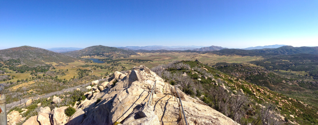
The Start of the hike starts just across from the Paso Picacho Campgrounds, as there is nowhere else to park for the beginning of the hike, pay your $8.00 entrance fee and enjoy the bathroom facilities before you start the hike. After you take care of business, carefully head across the highway to the other side of the road where the hike begins. At the trail head if you take a left you will meander up a gradual sloop through the dead forest, this is a horse trail and tends to be a little rocky, I liked coming down this way better. The way we headed up is the main route to your right, follow the sign and you can’t miss it. As you climb up look behind you across the valley and you will see the devastating effects of the 2003 cedar fire on the mountain, as much as I enjoyed this hike I keep wondering just how much nicer this hike would be if I where walking under a full tree canopy. If you can head out in the morning for this hike, practically the whole way up we where in the shade with the sun in the east behind the mountain, we started the trail at 8:30 am. The Trail is well maintained on the front side and well marked, its a nice peaceful hike. Once you make it to the top , take a right on the trail, go just a little further and you will see the Staircase that heads up to the peak, I wouldn’t worry about it even if your afraid of heights, one side has a little steep drop off, but its not really that bad. The trail wasn’t really that busy when we went, but if it was there wouldn’t be a whole lot of room for anyone at the top, there is room enough for about 10 people at the tip top of Stonewall Peak. After you have had your fill of the view, ( its hard to get enough on a pretty day) head back down, if you want to go back down the way you came up, the hike should be around 4 miles or so, if you want a little bit longer route with some different scenery, head back down the backside loop. As your heading down the trail, where the trail splits and goes back down the way you came up just keep going straight and you will hit the backside trail, as I said in the beginning this trail is meant as a horse trial and isn’t as well maintained, so watch your footing on the way down and be on the lookout for Poodle-Dog Bush which can leave a nasty rash, we keep a eye open for it but instead one of our party got stung by a bee. This trail is a lot more of a gradual incline and gives a really nice view of Lake Cuyamaca on the way down. We did come across a group of 6-8 deer close to the end of the hike, I think this would be a good family hike and most kids shouldn’t have much of a problem with it, its also nice to get out away from the desert environment in San Diego and see some mountains and trees. If you want to treat yourself after the hike, drive for a few miles north into the town of Julian and have some of there famous apple pie, I like Moms Apple Pie sweetened with natural apple cider at Moms Pie off of Main Street.
Weather forecast for the Stonewall Peak hike:


